
| |  | |
Modern day industry has propelled the demand for a slew of new courses spanning a varity of disciplines, cutting across industries.
For Melatthur Ramanathan Poduval, the choice couldn't be better. The Geography graduate was a topper of Kerala University. He did not want to go for a general MSc programme and computing excited him. He opted for the geoinformatics programme and has never looked back. He passed the Master's programme, worked with ISRO for a few years and is currently research lead in a private GIS company in the USA. The programme was very application-oriented he reminiscences. "We were forced to solve problems from day one and concepts flew from there," he asserts.
From instrumentation to medical biotechnology interdisciplinary is the way today. They give you basic grounding on the science involved and then train you rigorously on the technologies and the applications. Some like the Global Business Opportunity are business-oriented but are still unique in their offerings. And most of them do come cheap at about less than 4-5 lakhs rupees for a two-year programme, but offer careers which are comparable to the costlier MBA. They are worth a try.
MSc Geoinformatics
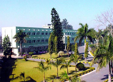
Institute: Indian Institute of Remote Sensing, Dehradun
Duration: 18 months
Fee: Rs 2.50 lakh (Self-sponsored Indian Candidates), $ 4500 (Foreign Candidates), Rs 2.50 lakh for travel and living in India and the Netherlands (Indian government-sponsored candidates)
Eligibility: First division in MSc/M.Tech (Physics, Mathematics, Statistics, Geology, Geography, Geophysics, Meteorology, Oceanography, IT, Agriculture, Urban & Regional Planning, MCA (with science), Natural Sciences, RS & GIS or equivalent)/or, BE/B.Tech. Degree (4 years) (Civil Engineering, Computer Science, Computer Engineering, IT, ECE, Agriculture Engineering, BSc Agriculture or Forestry, Geoinformatics or equivalent)
Address: Indian Institute of Remote Sensing, Indian Space Research Organisation, Dept. of Space, Govt. of India, 4, Kalidas road, P.B.No. 135, Dehradun-248001, Uttarakhand, India.
Website: www.iirs.gov.in/index.php
Other institutes: Osmania University, Hyderabad, Institute of Geoinformatics and Technology, Gurgaon, Symbiosis Institute of Geoinformatics, Pune, and more.
MSc in Geoinformatics trains students to administer geographic databases and work towards maintaining and developing spatial data (maps in the computer domain). It also familiarises students with the models and technologies related to Remote Sensing and Geographical Information System.
The course is structured in 15 theoretical modules and includes six months of Research MSc, research dissertation & Thesis defence at IIRS. The theoretical modules include Principles of Remote Sensing, Geodata Modelling & Processing, Web GIS Mapping & Programming, Visualisation and dissemination of Geospatial data and so on. This course will enable students to make a career in all the GIS and RS companies like Indian Space Research Organisation, National Mapping Organizations, State Remote Sensing Centres, Disaster management cell/centre, Spatial data Dissemination centres in India and abroad.
No comments:
Post a Comment